

Testing the Future of Disaster Management: Highlights from the First DMALIAN Pilot Trial

The TEMA project successfully completed its first pilot trial in Mantoudi, Evia (Greece) on 9–10 October 2025, testing the capabilities of its AI-powered platform for natural disaster management (NDM). The trial, known as the DMALIAN Pilot, focused on evaluating how advanced predictive analytics, simulation models, and real-time data fusion can enhance decision-making during natural disasters.
Aims and Objectives
The DMALIAN pilot aimed to assess the precision and accuracy of the platform’s predictions in a realistic flood scenario. Using the 2023 Elias storm and subsequent flooding as a reference event, the pilot tested how TEMA’s integrated technologies can support emergency responders in managing complex crisis situations.
Key objectives included:
- Assessing the platform’s ability to simulate and predict flood evolution.
- Testing integration with historical and live data sources, including satellite imagery, weather patterns, social media activity, and local geomorphological data.
- Evaluating the user interface and decision-support tools for civil protection agencies.
- Measuring the speed, quality, and reliability of the information provided to first responders in high-risk areas.
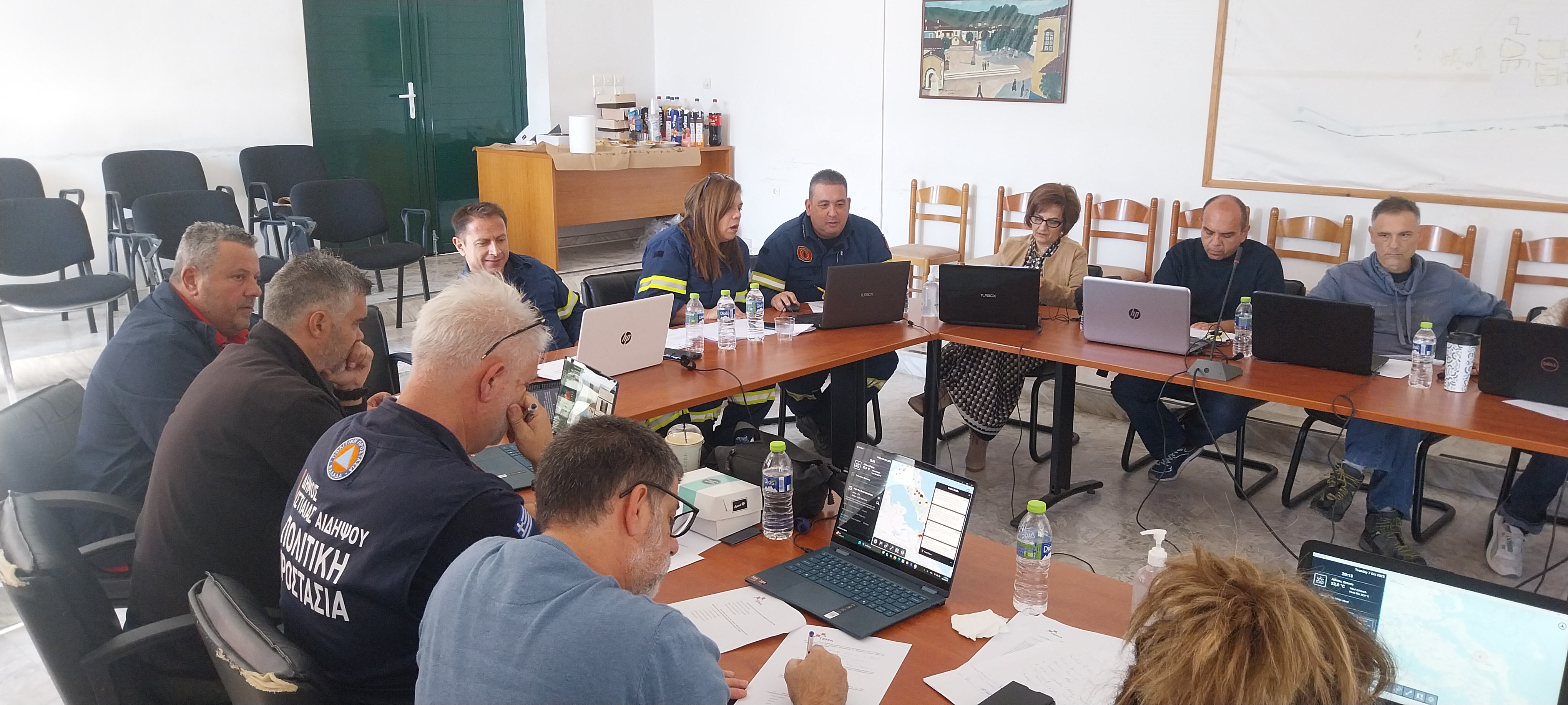
Setting and Participants
The two-day trial took place in Mantoudi, Evia, a region that experienced severe flooding during the Elias storm in 2023. Participants included representatives from the civil protection agency, fire department, police, coast guard, and medical services, as well as technical experts from the DMALIAN infrastructure department. In total, 10 evaluators and 2 observers took part in the exercise.
Trial Scenario and Technologies
The scenario was divided into three 30-minute phases, each focusing on different technologies or enhanced versions of the same tools. The tested components included:
- SV-tech-02 Digital Enabler and SV-tech-07 Smartdesk application
- 3Di Hydrodynamic Simulation (PDM-tech-02)
- Satellite-based Flood Detection and Assessment (TFA-tech-08)
- Geovisual Analytics (SV-tech-04)
- Drone-based Image Data Acquisition (SV-tech-01)
- Geo-Social Media Analysis (TFA-tech-11)
- Contrastive Language Model (TFA-tech-13)
- Information Fusion (PDM-tech-05)
These technologies combined to produce detailed simulation and visualization outputs, including flood maps, real-time data feeds, and fused information layers to support decision-making.
Activities and Preparation
Preparation for the pilot included:
- Two training sessions for participants, supported by KAMK partners.
- Multiple hackathons and coordination meetings with technical teams to refine the trial scenario.
- Evaluation and validation of historical datasets to ensure data quality.
- Deployment of the AI platform and real-time data ingestion from meteorological, geospatial, and social media sources.
- Post-event analysis and evaluation sessions led by KEMEA, gathering user feedback through questionnaires and guided discussions.
Key Findings and Next Steps
The pilot demonstrated the strong potential of the TEMA platform to transform disaster preparedness and response. Participants, all experts in natural disaster management, praised the platform’s speed, accuracy, and intuitive information fusion capabilities, particularly the visualization of critical data through interactive maps.
They also highlighted the value of future integration between the TEMA platform and existing operational tools already in use by first responders.
Overall, the first DMALIAN pilot trial laid the groundwork for the project’s next phase; defining objectives and improvements for the second pilot, and strengthening TEMA’s contribution to a more proactive, data-driven, and resilient approach to crisis management across Europe.