Methodology and Processing of the Model for the Forest Fire Risk Map
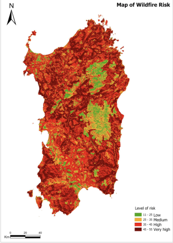
The articles seeks to illustrate the methodology used for the elaboration of the risk map, starting from cartographic bases, in order to obtain a product in raster format that allows rapid spatial analysis in a GIS environment for processing. It is based on the work previously presented "Methodology and Processing of the Model for the Forest Fire Risk Map".


