Mediterranean Flash Floods (Greece)
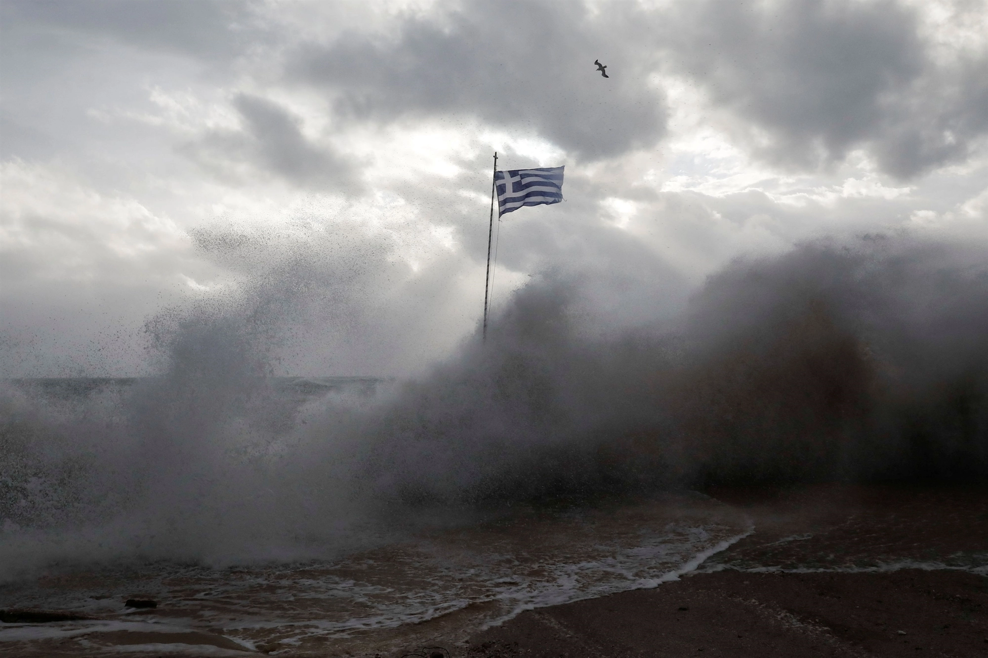
Mediterranean catchments are often characterized by steep slopes and dense hydrographic networks. Their particular geomorphology and hydrological characteristics, especially when combined with impermeable soils and/or urbanized zones, render such areas particularly prone to flash floods. Prior to (and during the evolution of) a flash flood event, the main challenge that needs to be addressed is the spatiotemporal accuracy in flood forecasting (and nowcasting). Typical flood forecasts, especially those issued on a European basis (e.g., from Copernicus), are usually provided at a coarse spatiotemporal scale and need to be downscaled, in order to serve as useful input to stakeholders (particularly during the prevention phase) and FRs (particularly during the response phase). The municipality of D.MALIAN can use its internal Department of Environment and Civil Protection as an operational room for evaluating the TEMA platform.
In the aftermath of the mega-fire of August 2021 and considering the particular geomorphology and land cover in the Greek pilot (Municipality of Mantoudi-Limni-Agia Anna), as well as the hydrometeorological regime of the greater area, extreme flash flood events are expected to occur, especially during the first post-fire period. The flood model will be set-up for the area. In the absence of relevant streamflow observations, the model will be calibrated based on information retrieved from historic flood events (i.e., historical records of water level during past flood events). On a (near-)real-time basis, the observations of streamflow gauges that will be installed in the area in the framework of the project, will feed the flood model and hence support (near-)real-time flood forecasting and flood warnings. The exploitation of TEMA tools and services will stimulate the responsible authorities and end-users to examine and further enhance the relevant NDM procedures.
First pilot in Greece
The first Greek pilot trial took place on 9–10 October 2025 in Mantoudi, on Evia Island, and recreated the severe 2023 flash-flood event using historical and synthetic data in order to evaluate the TEMA platform under realistic emergency-management conditions. The exercise brought together civil-protection authorities, firefighters, police, medical personnel and municipal responders to test how integrated technologies — including flood simulations, satellite-based monitoring, drone imagery, social-media analysis and geovisual analytics — could improve coordination and decision-making during fast-moving flood emergencies.
The trial demonstrated strong potential for improving situational awareness, accelerating access to critical information and reducing manual workload for emergency responders. Participants considered the platform more user-friendly and interactive than many existing systems, while highlighting the benefits of having a shared operational picture across multiple agencies. At the same time, the exercise identified several priorities for the next phase of development, including more dynamic flood forecasting, integration with external systems and better visualisation of vulnerable populations, evacuation routes and available response resources.
The next pilot iteration will take place in fall 2026.
Dimos Mantoudiou - Limnis - Agias Annas